
8 easy hikes in Iceland that you can do in any season
Together with road-tripping, hiking is probably one of the most fun ways to explore Iceland’s breathtaking scenery. Nowhere in the world will you find ice sheets and volcanos in such proximity and it would be a shame not to inspect them closely.
The hikes on this list are short & sweet and therefore well-suited for outdoor newbies. Even better, you can do them on a summer trip just as well as on a winter trip to Iceland. I did all the hikes on this list in late February/early March of 2024. If you’re a seasoned hiker who loves to tackle crazy elevation differences, these mini adventures will be a piece of cake.
Regardless of your experience, the hikes on this list offer a good introduction to the many layers of Icelandic landscapes. From fault lines to seas of ice and black sand beaches, they will give you a good taste of what Iceland is all about.

Hiking in Iceland is a great way to experience the local landscape
Can you hike in Iceland in the winter?
Before we get into the hikes, let’s address a concern you may have if you’re planning to visit the land of fire and ice in one of the more icy months: Can you even hike in Iceland in the winter?
The short answer is yes, you can. But there are limitations. Firstly, there can be as little as four to five hours of daylight in the middle of winter. Secondly, the weather is harsh and many trails are closed, inaccessible, or simply invisible due to the amount of snow.
That being said, if the weather allows, and you have the right equipment (i.e. crampons) and feel confident in your abilities, shorter hikes are definitely possible.

With the right equipment, hiking in Iceland in the winter can be a great activity
#1 Hike to Öxarárfoss waterfall in Thingvellir National Park
📏 Distance: 1.7 kilometres or more depending on the route you choose
⏱ Time needed: 30 to 60 minutes depending on the route
Thingvellir National Park is not only one of the three main attractions on the Golden Circle but also a place of geological and political significance. It was here, an area located on the Mid-Atlantic ridge that separates the North American and the Eurasian Plate, that Iceland’s ruling chiefs first met in 930.
A visit to Thingvellir National Park would not be complete without checking out Öxarárfoss. The best way to get to the waterfall is nothing else than a short walk. There are several ways you can go about it, from heading here straight from the parking lot to completing a 5+ kilometre loop around the park.
The easiest option — and the one I chose in the winter — is walking from the P1 parking lot. It’s a straightforward path, all you need to do is follow the signs to Öxarárfoss. It should take no more than 30 minutes to reach the waterfall.
I did it in the winter and despite the low(er) season, the place was crowded. Many tour buses stop here daily (if not hourly) to spit out tourists and leave them to explore the park. If you’re here in the summer, I would strongly encourage you to research alternative routes — and opt for a longer walk.

Öxarárfoss in the winter

Views in Thingvellir National Park
#2 Hike to Brúarfoss near the Golden Circle
📏 Distance: 3.5 kilometres one way
⏱ Time needed: one to two hours
Brúarfoss is a low-tiered waterfall on the aqua-blue river Brúará. They recently built a parking lot just five minutes away from this little wonder — but choosing to hike to Brúarfoss from the Brúará Trail parking will make your visit much more interesting.
The trail leads through private property and starts on Road 37, off the main Golden Circle road. This makes it a great side quest next to this popular tourist route — especially in the winter when most tourists focus on the more known attractions and skip this place entirely.
The hike is easy and flat and the surrounding landscapes are peaceful and quiet (at least in the winter). When I visited, we met no more than five other people on the trail.
At a good pace, you can easily complete the hike within one or two hours. Don’t rush it though. The other two waterfalls on the trail, Hlauptungufoss and Miðfoss, are worth spending a bit of time at.
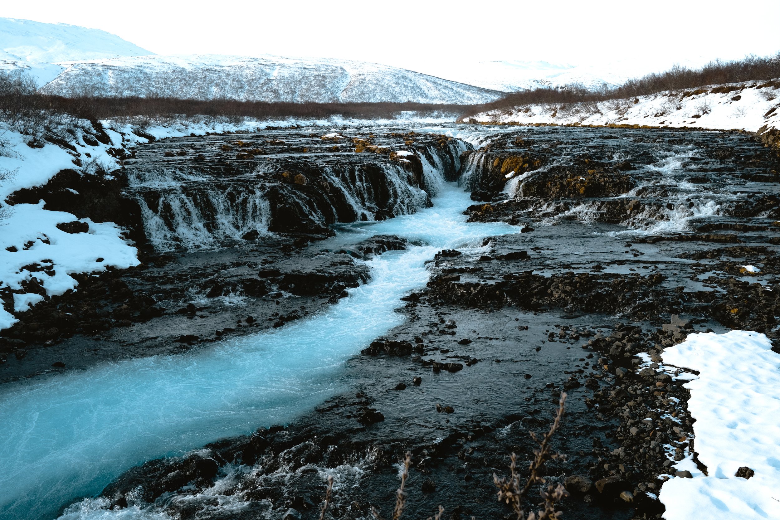
Brúarfoss is known for its beautiful colour
#3 Taste of the Waterfall Way hike above Skógafoss
📏 Distance: as far as you want to go
⏱ Time needed: one hour or more for visiting the waterfall and checking out the trail
Translated to “Forest Falls,” the 60 metres tall and 25 metres wide Skógafoss is probably one of the most visited waterfalls in Iceland. It’s an impressive giant and a starting point for the famous Fimmvörðuháls trail into the Icelandic highlands.
While completing this 25-kilometre-long hike sounds absolutely epic (duh), you don’t need to walk that far to enjoy nice views of the gorge of the river Skógá. Just a couple hundred metres into the trail and you’re already far enough from the crazy masses gathering at the bottom of Skógafoss.
Not everyone from the hoard of tourists walks up the stairs next to the waterfall and even fewer venture beyond the viewing platform at the top. A fact that is both surprising and actually quite nice if you need a moment of peace.
If you’re here in the summer and want a hiking adventure that takes at least a few hours, I would do the Waterfall Way hike which is actually a portion of the 25-kilometre trail.

Where most tourists gather to see Skógafoss

Views on the trail above the famous waterfall
#4 Mini hike to Kvernufoss
📏 Distance: one kilometre one way
⏱ Time needed: 30 to 60 minutes in total including time spent at the waterfall
Just a short five-minute drive from Skógafoss is Kvernufoss, denoted by some bloggers as the “hidden waterfall.” And while the place is no longer a secret, it does offer somewhat of a refuge from the large tourist masses.
The trail to Kvernufoss starts at the Skógar Museum parking lot and leads along a river into a mossy canyon. It only takes about 15 to 20 minutes to reach the waterfall.
Next to the beautiful landscape that feels right out of the Lord of the Rings, one of the most exciting things is that you can get behind the waterfall.
In the winter, everywhere the water reaches is practically covered with ice, so it gets extremely slippery. Put on your crampons and be aware of possible icicles hanging above your head.

Hiking to Kvernufoss is like stepping inside Lord of the Rings
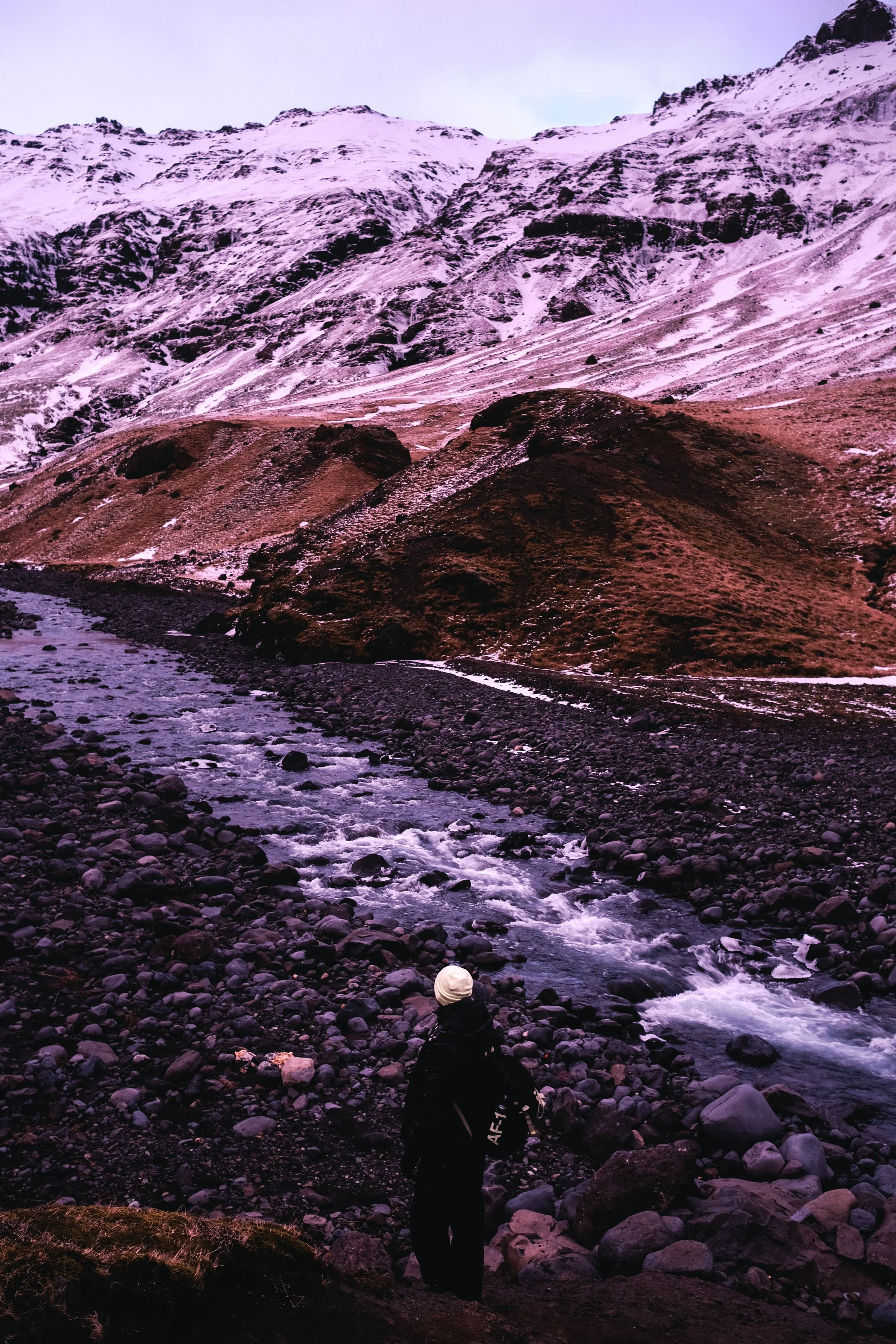
#5 Walk to the Sölheimajökull base
📏 Distance: about 850 metres one way
⏱ Time needed: 10 minutes one way
The base of Sölheimajökull, an outlet glacier of the Mýrdalsjökull ice cap, is where you can truly understand why Iceland is called “the land of fire and ice.” Ice giants covered with ashes from a volcanic explosion offer a sight that would be difficult to find anywhere else.
Sölheimajökull base is a starting point for glacier hiking tours. However, this place deserves a visit even if you’re not planning on doing one.
The walk from the parking lot takes no more than 10 minutes. The seemingly endless sea of ice stretches in front of you and the mountain peaks in the distance add grandeur to the landscape.
My favourite thing about this mini hike (or walk rather) was being immersed in this vast landscape and inspecting the different shapes and textures of ice — from the massive ice blocks of the ice cap to the tiniest ice crystals on the ground.
There’s a little viewing platform that allows you to observe the glacial lagoon with a bit of elevation.

Where the ice and ashes from a volcanic eruption meet
#6 Walk to Seljavallalaug swimming pool
📏 Distance: 1.8 kilometres one way
⏱ Time needed: 40 minutes to two hours in total including a visit to the pool
The mini hike to Seljavallalaug is a great way to finish a day of driving around Iceland’s south coast. One of Iceland’s oldest pools may not be as hot as other geothermal springs around the country, but it’s a good spot for a pleasant swim.
The short trail to the pool starts at a private parking lot, which you’ll reach after a quick but bumpy drive on a private road off Route 1 (aka the Ring Road) and Road 242. It takes around 20 minutes to walk to the pool. Even though the walk is not long, the trail follows a rocky river bed so it’s not a good idea to try and do it in flip-flops.
I’ve read that some other people had a bad experience at Seljavallalaug, which featured big tourist crowds and a lot of filth in the small building by the pool where you can change. I personally enjoyed my time here.
We visited at the beginning of March on an evening and only had to share the place with no more than five other people at a time. I did not step inside the building so I can’t say anything about that.
Regardless, if you come here at a quieter time of the day, just the tranquility of the surrounding landscape is well worth it. Especially when paired with the colours of sunset and dusk.

Visit Seljavallalaug in the winter around sunset and you might have it all to yourself
The trail to the outdoor pool follows a rocky river bed
#7 Hike along Fjaðrárgljúfur Canyon
📏 Distance: three kilometres
⏱ Time needed: around one hour with stops
The two kilometres long and 100 metres deep Fjaðrárgljúfur Canyon is a completely fascinating corner of the Earth, formed by water flowing from glaciers and eroding the rocks in its way. It looks straight out of a fairytale, like a natural fortress carved out by giants.
The canyon obtained its dramatic shape 10.000 years ago at the end of the last Ice Age. However, some of the bedrock is said to be as old as two million years!
The three-kilometre out-and-back trail pretty much copies the upper edge of the canyon. The walk starts by going uphill and then flattens out. There are a couple of viewing platforms where you can get relatively close to the edge and observe all the fascinating shapes below.
The path is slippery in the winter (though doable with crampons). We visited late in the day around sunset and only a few other wandering souls shared the trail with us.

Fjaðrárgljúfur looks like it was built by giants

The trail is easy and has plenty of nice views
#8 Walk to Sólheimasandur plane wreck
📏 Distance: 3.5 kilometres one way
⏱ Time needed: at least two hours
The abandoned DC-3 plane wreck at the Sólheimasandur beach is somewhat of a celebrity in Iceland. Even when it’s raining cats and dogs, people will apparently come to check out this popular spot.
While Sólheimasandur used to be accessible by car before it exploded in popularity, now there are only two ways to get here. One is a convenient but paid shuttle ride — something I didn’t try and wouldn’t even want to try, because it means you arrive at the same time as a crowd of other tourists.
The other is a hike. It doesn't per se guarantee a crowd-free experience, but it does raise the odds. The trail is easy and flat. Reaching the plane wreck takes 50 minutes of brisk walking on black sand and tiny pebbles surrounded by a landscape that feels like the middle of nowhere.
Some people say the hike is boring. Sure enough, there are no exciting twists and the scenery remains practically the same. But how often do you get to stroll on pitch-black sand by the Atlantic Ocean? 😉
The plane wreck is a popular spot for photography. Despite what you see some other people do, do NOT go standing on the plane to take your picture. It’s not allowed and your photo will be neither original nor cool.


The DC-3 plane wreck is a popular tourist attraction in Iceland and hiking is a fun way to get to it
———
Hiking is a great way to explore Iceland’s beautiful scenery and do more than just stop at every tourist attraction to snap a few photos. Whether you pick one mini hike or do all eight on this list, savour the journey and pay attention to the nature around you. It is for a reason that Iceland is one of the most beautiful countries in the world.


Have you done hiking in Iceland? What short & easy routes would you add to this list? Let me know in the comments below!